Table of Contents >> Show >> Hide
- What Does GPS Jamming Actually Mean?
- Why North Korea Uses GPS Jamming
- A Timeline of North Korean GPS Jamming Incidents
- Why the Incheon Area Matters So Much
- Jamming vs. Spoofing: The Difference Matters
- How GPS Became a Critical Infrastructure Weak Point
- Why Civil GPS Is Vulnerable
- What Can Aircraft and Ships Do During GPS Jamming?
- The International Legal Problem
- Is North Korea’s GPS Jamming a Cyberattack?
- Why This Matters Beyond Korea
- What Governments and Companies Should Do Next
- Experiences and Practical Lessons from GPS Jamming Scenarios
- Conclusion: GPS Jamming Is Small-Signal Warfare With Big Consequences
GPS is one of those modern miracles most of us treat like oxygen: invisible, everywhere, and only appreciated when it suddenly disappears. You tap a rideshare app, track a package, check a ship’s position, fly through cloudy weather, synchronize a bank transfer, or let your phone confidently tell you to “turn left” into what is clearly a lake. Behind all that everyday convenience is a fragile radio signal traveling from satellites more than 12,000 miles above Earth. And on the Korean Peninsula, North Korea has repeatedly shown that it knows exactly how fragile that signal can be.
Reports from South Korea have accused North Korea of jamming GPS signals near the inter-Korean border, especially around the western border areas close to Kaesong and Haeju. The disruptions have affected civilian aircraft, ships, and maritime navigation near South Korea’s west coast, including areas connected to the busy Incheon Flight Information Region. For a country that likes dramatic missile launches, military parades, and state television thunderclaps, GPS jamming may sound almost boring. But do not let the nerdy name fool you. GPS interference is electronic warfare with real-world consequences.
This is not just a technical squabble between two rival militaries. GPS jamming can complicate airline operations, make ships question their position, disrupt logistics, and expose how deeply modern economies depend on positioning, navigation, and timing systems. In other words, when North Korea jams GPS signals, it is not merely picking a fight with satellites. It is poking the nervous system of modern life.
What Does GPS Jamming Actually Mean?
GPS jamming is the deliberate broadcasting of radio noise on or near the frequencies used by satellite navigation systems. GPS satellites transmit extremely weak signals by the time those signals reach Earth. A receiver on an aircraft, ship, phone, or vehicle listens for signals from several satellites, compares timing data, and calculates position. The system is brilliant, but it is also vulnerable because a local jammer does not need to overpower the satellite in space. It only needs to overpower the satellite signal at the receiver.
Think of it like trying to hear a whisper from across a football stadium while someone next to you blasts an air horn. The whisper may still exist, but good luck making sense of it. That is the basic concept behind jamming. It does not necessarily create a fake location; it can simply deny access to accurate location and timing. Spoofing, a related but different tactic, involves sending false signals that trick receivers into believing they are somewhere else. Jamming says, “You cannot hear GPS.” Spoofing says, “You can hear GPS, but it is lying.” Neither is ideal when you are in a cockpit, on a bridge, or responsible for keeping cargo moving.
Why North Korea Uses GPS Jamming
North Korea’s GPS jamming fits into a broader pattern of gray-zone pressure: hostile activity that falls below the threshold of open war but still creates risk, confusion, and political tension. It is cheaper than firing missiles, less visibly dramatic than artillery drills, and easier to deny than a conventional attack. Yet it still sends a message to South Korea, the United States, Japan, and international aviation and maritime authorities: Pyongyang can disrupt normal life without crossing the clearest red lines.
It Is Cheap, Annoying, and Hard to Ignore
From North Korea’s perspective, GPS jamming offers an attractive cost-benefit ratio. The equipment required to interfere with satellite navigation is far less expensive than advanced missiles or aircraft. A jammer placed near the border can affect receivers over a wide area, particularly across water and flat coastal regions. The result is a low-cost tool that can create outsized disruption.
That does not mean every jamming episode creates catastrophe. Many commercial aircraft and ships have backup systems, trained crews, inertial navigation, radar, visual procedures, and air traffic control support. But safety is built on layers. GPS interference removes or weakens one of those layers, and aviation safety experts tend to be allergic to the phrase “probably fine.” In bad weather, congested airspace, or complex coastal waters, losing a reliable navigation input is not just inconvenient. It raises the workload for pilots, captains, controllers, and operators.
It Sends a Political Signal Without Launching a Missile
North Korea frequently mixes military signaling with psychological pressure. GPS interference has appeared during periods of heightened tension, including weapons tests, military exercises, balloon campaigns, and worsening relations with Seoul. By jamming navigation signals, Pyongyang can show technical capability, irritate South Korean authorities, and test responses from international bodies without necessarily triggering an immediate military confrontation.
In that sense, GPS jamming is a little like kicking the leg of a very expensive table. The table does not collapse every time, but everyone sitting around it notices. Airlines, shipping companies, airport operators, coast guards, defense planners, and diplomats all have to adjust.
A Timeline of North Korean GPS Jamming Incidents
North Korea has been accused of GPS jamming for years, not days. Earlier disruptions were reported in 2010, 2011, 2012, and 2016. South Korean officials and aviation experts have tied several major interference events to signals originating from North Korean areas near the border. In 2012, more than 1,000 aircraft and hundreds of ships reportedly experienced GPS disruptions over a 16-day period. In 2016, South Korea told the United Nations that jamming signals from North Korean regions threatened civilian aircraft and vessels.
The issue returned with new urgency in 2024 and 2025. South Korean authorities reported GPS disruptions affecting civilian aircraft and vessels, particularly near the western border and around the Incheon Flight Information Region. The International Civil Aviation Organization later expressed grave concern about continuing GNSS radio frequency interference originating from North Korea and warned that such activity jeopardizes the safety of international air navigation.
The pattern matters. A one-time disruption might be dismissed as reckless experimentation. Repeated incidents over more than a decade suggest doctrine, training, and intent. North Korea appears to understand that GPS is a dependency worth targeting.
Why the Incheon Area Matters So Much
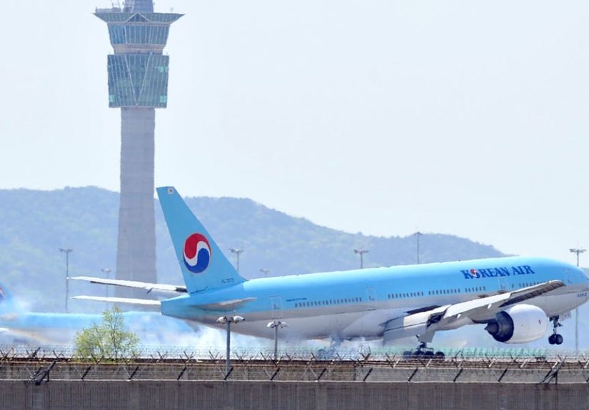
South Korea’s Incheon International Airport is one of Asia’s major aviation hubs. It handles large volumes of passengers and cargo and sits relatively close to North Korea. That geography makes the region especially sensitive to navigation interference. Aircraft operating near Seoul and Incheon do not rely on GPS alone, but GPS supports modern aviation functions including navigation, surveillance, timing, and certain approach procedures.
When GPS becomes unreliable, airlines and pilots can use alternate procedures, but disruption still has operational consequences. Flight crews may need to cross-check instruments more aggressively, air traffic controllers may issue additional instructions, and airlines may adjust routing or procedures. In a perfect blue-sky scenario, that may be manageable. In poor visibility, bad weather, heavy traffic, or an emergency, losing GPS accuracy becomes far more serious.
Ships face similar problems. Modern vessels use GPS for navigation, tracking, route planning, electronic chart systems, and Automatic Identification System data. A ship that loses GPS may still have radar, visual references, paper charts, gyrocompasses, inertial tools, and experienced officers. But when position data becomes unreliable, the bridge team must slow down mentally, verify everything, and treat automation with suspicion. That is good seamanship, but it also shows why jamming is dangerous: it turns routine navigation into a more fragile exercise.
Jamming vs. Spoofing: The Difference Matters
The public often uses “GPS jamming” as a catchall phrase, but jamming and spoofing are not identical. Jamming overwhelms GPS receivers with noise, causing signal loss or degraded accuracy. Spoofing is more deceptive. It sends counterfeit signals that may cause a receiver to calculate a false position, speed, or time.
Both methods can create safety risks, but spoofing may be more insidious because the receiver might still appear to be working. A jammed receiver is like a person saying, “I cannot see.” A spoofed receiver is like a person confidently pointing in the wrong direction while wearing a captain’s hat. In aviation and maritime settings, confidence in bad data can be worse than no data at all.
Reports around the Korean Peninsula have referred to both GPS interference and possible spoofing concerns. Whether a specific incident involves jamming, spoofing, or a mix of interference patterns, the larger point is the same: satellite navigation signals are vulnerable, and hostile actors can exploit that vulnerability.
How GPS Became a Critical Infrastructure Weak Point
GPS began as a military system, but it became a backbone for civilian life. Today, it supports aviation, shipping, agriculture, telecommunications, finance, emergency response, construction, surveying, trucking, power grids, and smartphone apps. The “P” in GPS gets most of the attention because people think of location. But the timing function is just as important. Many networks rely on precise GPS time synchronization. If timing becomes unreliable, systems that never show a map can still be affected.
This is why government agencies and infrastructure experts increasingly talk about PNT: positioning, navigation, and timing. GPS is not merely a convenience layer. It is part of the hidden plumbing of the global economy. When that plumbing gets rattled, the water may still flow, but engineers start paying attention very quickly.
Why Civil GPS Is Vulnerable
Civil GPS signals are open and widely accessible by design. That openness is one reason GPS became so useful. Manufacturers can build receivers for cars, phones, drones, tractors, aircraft, and ships. But open access also means public signals are easier to imitate or disrupt. Many receivers were built in an era when the main assumption was signal availability, not hostile manipulation.
The signal strength problem is even more basic. GPS satellites are far away, and their signals arrive at Earth faintly. A nearby transmitter broadcasting interference can drown out those signals. The jammer does not need cinematic supervillain technology. It simply needs enough power, the right frequency range, and a location that gives it reach.
That is why GPS resilience has become a serious topic for governments, airports, shipping companies, and critical infrastructure operators. The answer is not to abandon GPS. The answer is to stop treating GPS as magical and invincible.
What Can Aircraft and Ships Do During GPS Jamming?
Professional operators do not simply shrug and hope the satellites feel better. Aviation and maritime crews train for equipment failures and navigation anomalies. When GPS interference appears, pilots can notify air traffic control, compare GPS data with inertial navigation systems and ground-based aids, follow published procedures, and avoid relying on a single source of position data. Ships can cross-check radar, visual bearings, electronic charts, depth soundings, compass data, and traffic information.
The key principle is redundancy. GPS should be one tool in the toolbox, not the entire toolbox duct-taped to the wall. Systems that combine satellite navigation with inertial sensors, terrestrial radio navigation, radar, and disciplined human procedures are more resilient. Airports and maritime authorities can also improve reporting channels so interference is detected, mapped, and communicated quickly.
South Korea’s Interest in eLoran
One major backup option often discussed in South Korea is eLoran, an enhanced version of a long-range terrestrial radio navigation system. Unlike GPS, which depends on weak signals from space, eLoran uses powerful ground-based transmitters. That makes it much harder to jam over broad areas. South Korea has explored eLoran as a national backup for maritime and infrastructure resilience after repeated North Korean GPS interference.
eLoran is not a perfect replacement for GPS, and no single backup system solves every problem. But it reflects the right strategy: build layers. If one system fails, another should keep essential operations moving. In a region where North Korea has repeatedly targeted GPS, layered resilience is not a luxury. It is common sense wearing a hard hat.
The International Legal Problem
GPS jamming that affects civil aviation and maritime safety is not just rude behavior with antennas. International aviation rules emphasize the safety, regularity, and efficiency of air navigation. When interference affects aircraft operating in international airspace or flight information regions, it becomes a matter for international bodies such as the International Civil Aviation Organization.
South Korea has repeatedly raised North Korean GPS interference with international organizations. ICAO has condemned harmful radio frequency interference affecting civil aviation safety and urged North Korea to stop disruptive activity. That matters because it frames GPS jamming not as a bilateral nuisance but as a threat to international transportation safety.
Still, enforcement is difficult. North Korea is already heavily sanctioned, politically isolated, and accustomed to international condemnation. A formal warning may not change Pyongyang’s behavior overnight. But documentation, diplomatic pressure, and coordinated reporting help establish accountability. They also help airlines, insurers, shipping companies, and governments assess risk more clearly.
Is North Korea’s GPS Jamming a Cyberattack?
GPS jamming sits at the intersection of electronic warfare, cyber risk, and infrastructure security. It is not a traditional cyberattack in the sense of hacking a server or stealing data. No one needs to break into a computer network to jam GPS. But the effects can overlap with cyber disruption because GPS feeds digital systems that make automated decisions.
For example, a navigation device may lose position. A tracking platform may display inaccurate vessel movement. A drone may fail to complete a route. A timing-dependent network may experience degraded performance. The attack happens in the radio frequency environment, but the consequences ripple into software, logistics, safety systems, and decision-making.
That is why GPS interference should be treated as part of a broader security problem. Modern conflict does not politely stay in one category. It wanders across military, civilian, digital, economic, and psychological spaces like a raccoon in an open garage.
Why This Matters Beyond Korea
North Korea is not the only actor associated with GPS interference. Around the world, GNSS jamming and spoofing have been reported near conflict zones, sensitive borders, and maritime chokepoints. The Korean Peninsula is one of the clearest examples of how a state can use navigation disruption as a pressure tactic, but the lesson is global.
Airlines flying near unstable regions, ships operating in contested waters, drone operators, emergency responders, telecom companies, and financial institutions all need to consider what happens when GPS becomes unreliable. The question is no longer, “Can GPS fail?” The question is, “What keeps working when it does?”
For everyday users, the impact may seem distant. Your phone may still find the nearest coffee shop, and your delivery app may still claim the driver is “two minutes away” for 11 heroic minutes. But the systems affected by GPS interference are the same systems that move goods, guide aircraft, coordinate rescue operations, and support critical infrastructure. GPS jamming is a reminder that convenience and vulnerability often travel in the same suitcase.
What Governments and Companies Should Do Next
The first step is better detection. Operators need tools that can identify jamming and spoofing quickly rather than treating every anomaly as a device glitch. The second step is reporting. Pilots, ship crews, infrastructure operators, and telecom teams should know where and how to report GPS interference. The third step is resilience planning. Organizations should map which systems depend on GPS and determine how long they can operate safely if signals degrade.
Companies should also train staff not to blindly trust automated location data. A GPS readout is useful, but it should not become a sacred text. In high-risk environments, teams should cross-check position and timing data against independent sources. Governments can support this by investing in backup PNT systems, encouraging resilient equipment standards, and sharing interference alerts quickly.
The best defense is not panic. It is preparation. GPS jamming works best when users are surprised, overdependent, and slow to respond. It works far less well when crews, controllers, engineers, and managers already know the playbook.
Experiences and Practical Lessons from GPS Jamming Scenarios
Imagine a cargo ship approaching a busy coastal lane near South Korea’s west coast. The watch officer is monitoring electronic charts, radar, AIS targets, and GPS position. Suddenly, the GPS position begins to drift or disappears. Nothing explodes. No alarm announces, “Congratulations, you have entered an international security incident.” Instead, the bridge team notices small inconsistencies. The ship icon is no longer where radar and visual references suggest it should be. AIS targets look odd. The electronic chart is still beautiful, colorful, and completely capable of being wrong.
The experienced response is calm verification. The crew checks radar ranges, compass bearings, depth, visual markers, and other navigation inputs. Speed may be adjusted. The captain may be called. Nearby vessels and traffic services may be contacted. The incident becomes manageable because people recognize that GPS is a tool, not a promise from the heavens.
Now picture a commercial flight crew operating near a region with known GPS interference. In cruise or approach preparation, the aircraft may flag a navigation anomaly. The crew does not toss the manual out the window and navigate by vibes. They follow procedures, compare systems, advise air traffic control, and use approved alternatives. Modern aviation is designed with redundancy, but redundancy only works when humans respect it. A GPS disruption is not automatically an emergency, yet it can increase workload at exactly the wrong moment.
For passengers, the experience may be invisible. Your flight may land normally. Your luggage may still somehow take a spiritual journey through three airports, but that is probably not North Korea’s fault. Behind the scenes, however, GPS interference forces professionals to spend more attention on cross-checking and contingency planning. That attention is valuable, but it is also finite. Safety systems are strongest when they reduce unnecessary workload, not when they add surprise chores.
There is also a lesson for businesses far from the cockpit or ship bridge. Logistics companies, telecom providers, financial networks, drone operators, and emergency services should ask uncomfortable questions before a disruption happens. Which systems rely on GPS timing? Which dashboards assume location data is accurate? Which teams know how to detect spoofing or jamming? Which operations can continue safely without satellite navigation for one hour, one day, or longer?
The North Korea example shows that GPS resilience is not only a military issue. It is a business continuity issue. It belongs in risk assessments, training programs, procurement decisions, and incident response plans. A company that depends on GPS but has no backup plan is essentially driving at night with one headlight and a lot of confidence.
The most useful mindset is healthy skepticism. When GPS data looks wrong, treat it as wrong until proven otherwise. When operating near known interference zones, assume disruptions are possible. When buying equipment, ask whether it can detect anomalies, use multiple constellations, integrate inertial sensors, or support authenticated signals where available. When training people, teach them to verify rather than merely observe.
North Korea’s GPS jamming is a warning signal in more ways than one. It warns South Korea and its allies about Pyongyang’s electronic warfare ambitions. It warns airlines and shipping operators that navigation interference is no longer rare. And it warns everyone else that the invisible systems supporting modern life deserve more respect, more backup, and fewer assumptions. GPS is amazing technology. But like all amazing technology, it becomes safer when people remember that it can fail.
Conclusion: GPS Jamming Is Small-Signal Warfare With Big Consequences
North Korea’s repeated GPS jamming is not just another headline from a tense peninsula. It is a case study in modern disruption. By targeting weak satellite navigation signals, Pyongyang can create confusion for aircraft, ships, and infrastructure without firing a shot. The tactic is relatively cheap, politically useful, and difficult to ignore.
The good news is that GPS jamming does not make aviation or maritime navigation helpless. Professional crews have backup systems and procedures. Governments can improve reporting, detection, and international pressure. Companies can build redundancy into systems that rely on positioning, navigation, and timing. The bad news is that too many modern operations still treat GPS as if it were permanent, perfect, and protected by a force field.
The smarter lesson is simple: GPS is essential, but it should not be lonely. Resilient navigation requires backups, training, monitoring, and the humility to verify what the screen says. North Korea has turned GPS jamming into a recurring pressure tactic. The rest of the world should turn it into a reason to build stronger systems.
Editorial note: This article is based on real reporting and official aviation, maritime, and positioning-navigation-timing guidance. Source links are intentionally not included in the article body for publishing convenience.